
assateague island photos
Asseteuge island Photos
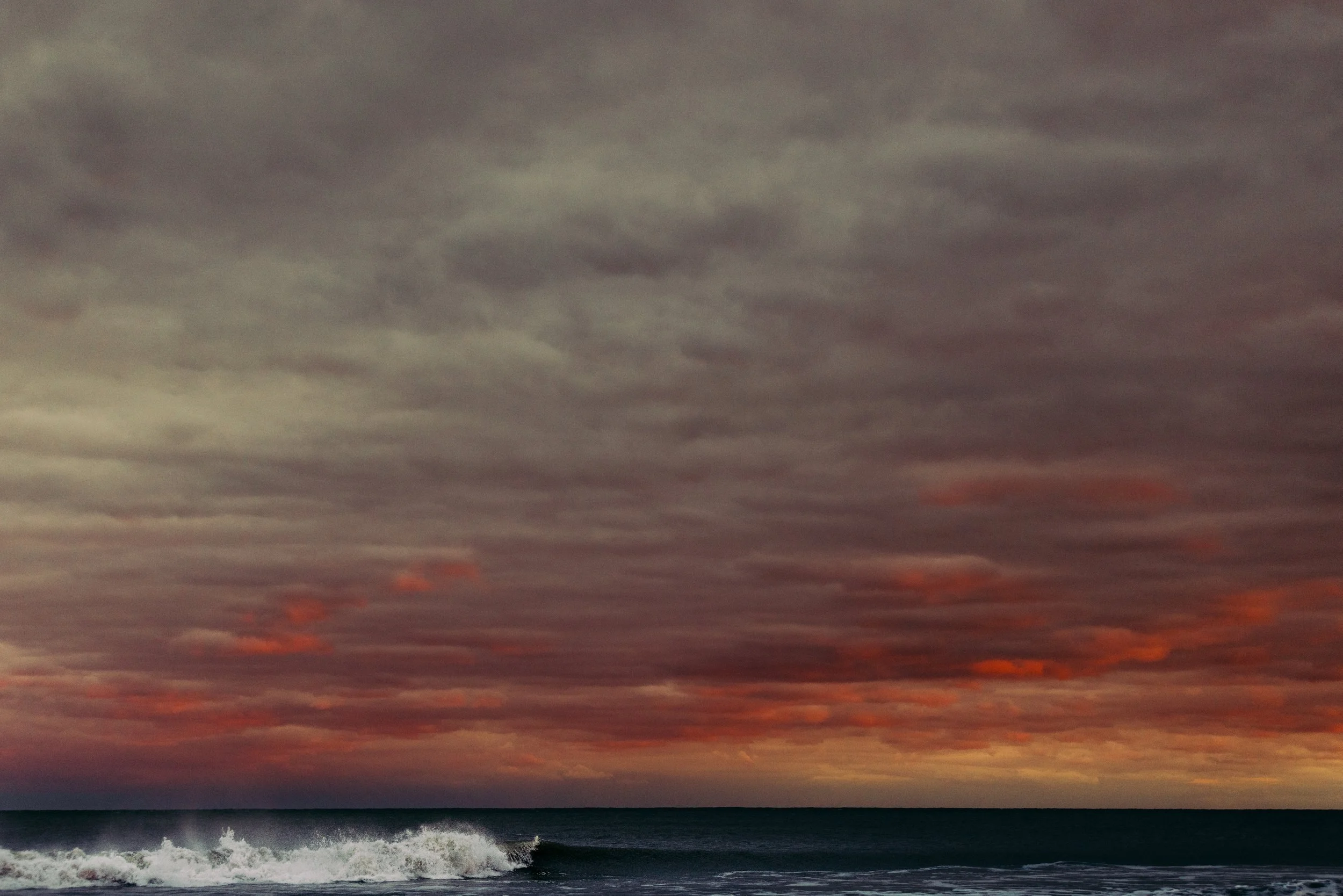
These Asseteuge island photos, were taken on the barrier islands of Assateague and Chincoteague, located in Maryland, USA. Asseteuge island is protected from stormy seas by the barrier islands of Assateague and Chincoteague in the Atlantic Ocean. One of the most plausible explanations is that they were survivors of the La Galga shipwreck in 1750, which occurred in Spain. The Assateague Island National Seashore, with its 37 miles of shoreline. Asseteuge Island boasts incredibly beautiful scenery abounds in this enthralling location.

Full Asseteuge Island photo collection can be viewed in full by clicking here.
“Timeless heartbeats, endless days, in a place of shallow waters and wild waves”

Full Asseteuge Island photo collection can be viewed in full by clicking here.
Wild horses roam
Wild horses roam graze in the marshes, brown pelicans swoop down to the ocean's surface, and birds swoop in and out of the clouds. Several of the Spanish ponies are said to have swum to the islands surrounding Assateague and Chicoteague after their shipwreck along this stretch of the North American coast. Adding to the region's charm and wonder. There is a good chance that the ponies were previously owned by locals and became a feral herd in the 17th century.

Full Asseteuge Island photo collection can be viewed in full by clicking here.
Asseteuge island photos
All photographs take by Lukas Griffin in November 2021.

Full Asseteuge Island photo collection can be viewed in full by clicking here.
History of Asseteuge Island
Assateague was not included on the earliest European maps. They only reveal signs of moving sand bars at the most. In many ways, Assateague has been a succession of islands rather than a single connected island. There were washovers all across the island's barrier. Sometimes these naturally produced inlets remained in the same places, although this was not always the case. Sinepuxent, Green Run, and Pope's Island were the names of three recurrent inlets between Ocean City's current inlet and the Chincoteague inlet.

Full Asseteuge Island photo collection can be viewed in full by clicking here.
origin of Assateague's name
Assateague's name has been interpreted as "the river beyond," "a place across," "a running stream between," or "swiftly moving water," depending on the context. At the time of the European invasion, it was also given to the local tribes. There were no white explorers in the area for more than three hundred years. Summered on the island and wintered in nearby communities that were protected from the severe oceanic winters, as evidenced by records of early visitors to the island. They weren't on vacation when they arrived on the island. In preparation for the next months, they were hard at work collecting and conserving fish and game. All of the waterfowl they collected were smoked over large fires and taken in baskets to the main land where they were concealed in underground caches to be used throughout the winter.. However, the tribes viewed the island as a part of their territory, but not necessarily as their possessions.
Full Asseteuge Island photo collection can be viewed in full by clicking here.
English settlers and native tribes
In 1632, King Charles I of England included Assateague Island in the Maryland land charter granted to Lord Baltimore, Cecil Calvert. When Colonel Edmund Scarborough launched a campaign to steal Maryland's Eastern Shore counties for his own home colony of Virginia in the early 1660s, relations with the native peoples were still reasonable but deteriorating. Distrust and downright animosity between the English settlers and native tribes was part of his approach. After his forces arrived, he thought he could claim the territory for Virginia as a result of his military success. King or Emperor of the Assateague was now the head of an alliance of many tribes from present-day Worcester and Somerset counties. He sought assistance from the Maryland courts. Calvert's government signed an agreement in 1668 with Scarborough recognizing the current line between Maryland and Virginia. By then, however, the cards had been dealt and most of the so-called Indian tribes had been driven from the area.

Full Asseteuge Island photo collection can be viewed in full by clicking here.
Asseteuge Island 1680s - 1715
Captain Daniel Jenifer and his wife Anne Toft received a land grant on Assateague Island in the 1680s, and they settled on the southern end of the island. Captain William Whittington was given a gift of 1,000 acres on the north end of the island in 1702. ' Baltimore's Gift" was the name of his patent, and he used the property to graze livestock. Capt. Whittington began dividing his share of the island's north end into parcels for sale as early as 1715. Those who bought them were usually unsuccessful, and they were left to rot.

Full Asseteuge Island photo collection can be viewed in full by clicking here.
Asseteuge island myths
It has been the subject of numerous myths, some of which are based on fact.
There is a possibility that the account of the Greyhound, a Spanish frigate that sank off the coast of Assateague on September 6, 1750, sparked the island's famed pony mythology. Ship's crew unloaded a large chunk of their cargo, including numerous chests of Spanish silver, after the ship ran aground near the beach in bad weather. At first it was difficult to move the dories and silver, but eventually it was possible to do so across the sand dunes and then across the inshore bays to reach the mainland.
Local wreckers began dismantling the Greyhound as soon as they landed safely on the other side. Because shipwrecks off the coast of Assateague were so regular, the little communities that were springing up around them began to see an influx of new citizens looking for work. These people were dubbed "wreckers" by the locals. The crew's personal items, the boat's hardware and fittings, and even some of the wooden beams and decking of the Greyhound were all taken by the pirates. Snow Hill, where the ship's captain Daniel Huony had arrived, had received a strong complaint from Huony. As a result of this and other such incidents, maritime salvage rules were enacted.

Full Asseteuge Island photo collection can be viewed in full by clicking here.
rumors of the time
There were rumors at the time that the Greyhound had horses on board and that they escaped during the storm. Some believe they were the first of the Assateague pony herds. Worcester County farmers had already been grazing their cattle and horses on the island for many years, thus this is highly unlikely. In an effort to reduce their tax burden, livestock owners may have supported the spread of myths about Spanish horses.
The U.S. Lifesaving service was established to deal with the problem of ships being stuck on the continuously shifting shoals off our coast. The service purchased land to build lighthouses and rescue stations, and paid surfmen to patrol the beaches. Green Run and Assateague Beach, the first Delmarva Life-Saving Stations, were constructed in 1875 on the Maryland end of Assateague Island. The number of shipwrecks substantially decreased as the shipping industry improved with safer steam-powered vessels and better navigation equipment.
The remaining wreckers began fishing instead of salvaging at this time. The communities had just one school and no churches, but the faithful gathered in private houses to pray and worship. On the island, it was difficult to find land that could be used for subsistence gardens, but some of the inland bay islands did. Residents' children frequently fled their isolated island communities in search of a better life elsewhere.

After the Civil War
North Beach had a development in progress and Green Run had a hotel erected after the Civil War. Land speculators purchased parcels and then attempted to resell them. Ocean City's inlet was formed in 1933 by a storm that also wrecked the train bridge to the mainland, putting the towns south of it at risk.
In 1935, the National Park Service was still in its infancy, and a push was started to turn the island into a public park. Otis Bland, a Virginia congressman, introduced legislation to set the ball rolling. Nevertheless, the plan was put on hold because Worcester County officials refused. Landowners in Virginia sold most of their parcels to the U.S. Fish and Wildlife Service in 1943 because the southern end of the island's development potential was thought implausible. The federal duck stamp program was used to buy the property for $75,000. That was the first park.
It was in the 1950's that a New York retiree called William Green took up the cause to "Save the Island from the Sea and the Honky-Tonk," and he was successful. To convince local and state lawmakers, he formed a committee with 46 other Worcester County residents and later expanded to include residents from all over the state. They argued that a wildlife preserve and recreation area would generate more tax revenue than a development that would necessitate ongoing, expensive infrastructure costs.

Full Asseteuge Island photo collection can be viewed in full by clicking here.
The next development
The next development boom began without any resolution. Assateague Island was purchased by the Ocean Beach Corporation, which sold over 6,000 lots to around 3,200 persons. Connected the island to the county's power system and updated the phone connections. A few minor issues stalled progress, though. They had no idea how they were going to handle the sewage that would be generated by the new community. And there was only one ferry service that could get you to the island.
During the devastating Ash Wednesday nor'easter of March 1962, the island's infrastructure was wiped out, thereby killing the project. In Ocean Beach, Maryland, only eight of the forty-eight residences that had been erected were still standing.
After the disaster, the state of Maryland worked out a deal with the federal government and the county to acquire a piece of the island for their own park. Assateague State Park was built on land that had been earmarked for a second Atlantic City. We now had a second park.
The Ocean Beach Corporation went bankrupt in 1965 and sold all of its assets to the federal government, including the beach. According to President Lyndon Johnson, we should leave future generations with more than merely a "glimpse of the earth as God fashioned it" by signing legislation to establish Assateague Island National Seashore on September 21 of that year. Johnson signed the legislation. Assateague now has a total of three parks.
Negotiations and acquisition of the remaining parcels of land on the island, including several hunting lodges, took almost a decade. Their benefactors benefited from preferential treatment. In exchange for their property, they received a payment and a lease that might last up to 25 years. Those days are long gone now. The park service has abandoned and let to "naturally waste away" any of the hunting and fishing clubs' buildings. Only the most adventurous hikers make the trek to the island's remote backcountry to locate these eerie ghost buildings.
Assateague's ever-changing seashore and abundant wildlife continue to captivate us
Assateague's ever-changing seashore and abundant wildlife continue to captivate us. It's a coastal treasure that draws tens of millions of tourists each year with its clean beaches and well-kept visitor amenities. We don't know where the island will be 100 years from now. Thank you to whoever saved Assateague for us in whatever form it may have taken in the recent past.